
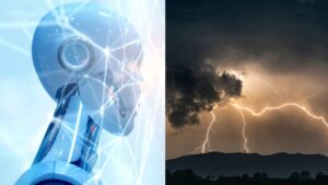
 In a major leap for weather forecasting, researchers have successfully trained artificial intelligence to predict localized thunderstorms with remarkable speed and accuracy marking a turning point for emergency preparedness and public safety.
Traditionally, AI has been used to generate global-scale weather forecasts, but its effectiveness at smaller scales like predicting individual thunderstorms was limited due to a lack of high-resolution data. That changed when scientists Flora and Potvin trained Google’s powerful neural network, GraphCast, on data from the National Oceanic and Atmospheric Administration’s (NOAA) Warn-on-Forecast System.
The result is WoFSCast an AI model capable of accurately simulating key storm dynamics such as updrafts and cold air pockets. These features play a critical role in the intensity, direction, and growth of thunderstorms. WoFSCast’s predictions closely aligned with NOAA’s forecasts, achieving 70% to 80% accuracy compared to the standard Warn-on-Forecast output.
What’s more, the AI-generated forecasts are lightning fast. WoFSCast can produce a 2-hour forecast in just 30 to 40 seconds using a single GPU making it at least 10 times faster than current non-AI methods.
This innovation could be a game changer for the National Weather Service, which may soon be able to issue severe weather warnings more quickly and with greater precision. Faster alerts could significantly reduce the impact of tornadoes, flash floods, and severe thunderstorms.
Looking ahead, the researchers believe WoFSCast could be adapted to forecast a wider range of extreme weather events, including surface winds and rainfall from tropical cyclones, or even the spread of wildfires.
With climate-related disasters becoming more frequent and intense, this new AI-driven approach could play a critical role in protecting lives and property.