Anti-Smog Guns & AI Cameras in Delhi’s 2025 Air Pollution Mitigation Plan
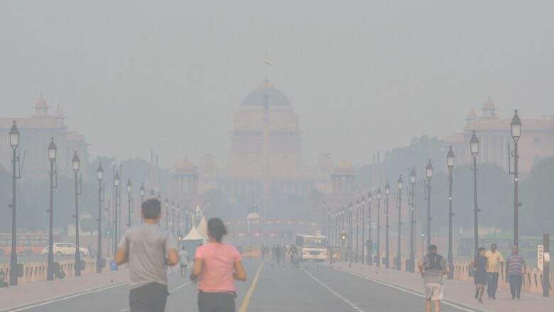
With Delhi air quality once again under global scrutiny, Chief Minister Rekha Gupta on Tuesday rolled out the Air Pollution Mitigation Plan 2025 a bold, tech-powered initiative to combat the capital’s perennial pollution crisis.
Under the sweeping measures:
▸ Anti-smog guns are now mandatory for all high-rise commercial structures in Delhi malls, hotels, and office complexes exceeding 3,000 sq metres.
▸ Mist sprayers will be deployed at 13 identified air pollution hotspots across the city.
▸ From 1 November, only BS-VI compliant, electric, and CNG vehicles will be allowed to enter Delhi’s borders.
Gupta’s announcement marks one of the most stringent efforts to date in tackling the city's toxic air, especially as Delhi braces for yet another hazardous winter season.
AI Cam...