Tuesday, July 1News That Matters

Tag: Bay of Bengal

Deep depression crosses Bengal coast, triggers heavy rain and squalls across eastern, northeastern India

Deep depression crosses Bengal coast, triggers heavy rain and squalls across eastern, northeastern India

Breaking News, Climate Actions, Environment
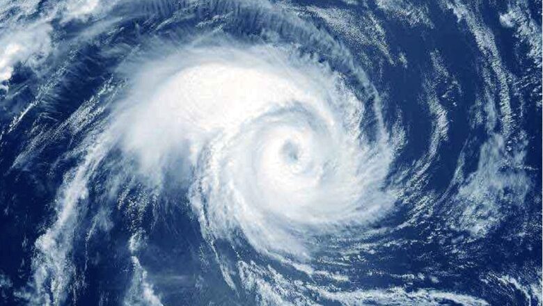
A deep depression over the northwest Bay of Bengal crossed the West Bengal-Bangladesh coast near Raidighi on the morning of May 29, 2025, bringing with it widespread heavy rainfall and squally winds. The India Meteorological Department (IMD) reported that the system moved inland between 10:30 am and 11:30 am, between Sagar Island and Khepupara. The weather system is expected to move north-northeastwards and gradually weaken into a depression by the evening. However, its impact will continue to be felt across large parts of eastern and northeastern India. The IMD has forecast extremely heavy rainfall in Meghalaya on May 30, with isolated areas likely to see over 30 centimetres of precipitation. Assam is also bracing for extreme rainfall, with forecasts of over 20 cm in some places. Th...
Early Monsoon Onset May Be Strong—But Faces Risk of Stalling Again

Early Monsoon Onset May Be Strong—But Faces Risk of Stalling Again

Breaking News, Climate Actions, Environment
India is set for an early and seemingly strong onset of the Southwest Monsoon, but weather models and past trends are raising red flags about a possible stall. The emergence of twin cyclonic systems one in the Arabian Sea and another in the Bay of Bengal could disrupt the seasonal rains just as they begin. Monsoon Arriving Early Kerala to See Rains Before June 1 The India Meteorological Department (IMD) announced that the monsoon has already advanced over parts of the southern Arabian Sea, the Maldives, the Bay of Bengal, and Northeast India. According to their May 21 bulletin, conditions are rapidly becoming favorable for the monsoon to reach Kerala between May 24 and May 27 about a week ahead of the June 1 average. Twin Cyclonic Systems Could Disrupt Monsoon Progress Desp...
Monsoon Extremes Put Marine Life At Risk in Bay of Bengal: Warns Study

Monsoon Extremes Put Marine Life At Risk in Bay of Bengal: Warns Study

Breaking News, Climate Actions, Environment
A groundbreaking study has revealed that both extremely strong and weak monsoons have historically led to a 50% decline in food availability for marine life in the Bay of Bengal. Researchers warn that with climate change likely to worsen monsoon variability, marine productivity and millions of livelihoods are at serious risk. Monsoons: A Double-Edged Sword for Marine Ecosystems In the dynamic environment of the Bay of Bengal, monsoons play a central role in ocean health. But this new research, conducted by teams from the University of Arizona and IIT Gandhinagar and published in Nature Geoscience, finds that monsoon extremes are harmful, regardless of whether rainfall is too much or too little. The culprit is disrupted ocean mixing, the vertical movement of water that brings nutri...
Massive Underwater Landslide Discovered in Krishna-Godavari Basin: Potential Tsunami Threat Identified

Massive Underwater Landslide Discovered in Krishna-Godavari Basin: Potential Tsunami Threat Identified

Breaking News, Disasters, Fact Check
A massive underwater landslide in the Krishna-Godavari (KG) basin, reaching depths of 950 meters to 1.1 kilometers below the ocean surface, has raised concerns about its potential to trigger a tsunami and disrupt critical infrastructure. The discovery was announced by the Goa-based National Institute of Oceanography (NIO), which described the landslide as one of the largest ever recorded in this part of the Bay of Bengal. The landslide, which could have occurred between 2009 and 2015, displaced an estimated 11 cubic kilometers of sediment—enough to fill around 44 lakh Olympic-sized swimming pools. At some points, sediment deposits from the landslide are as thick as 60 meters, covering an area of approximately 70 square kilometers, equivalent to 10,000 football fields. “The enormous d...
Low-Pressure Area in Bay of Bengal to Bring Heavy Rainfall to Tamil Nadu

Low-Pressure Area in Bay of Bengal to Bring Heavy Rainfall to Tamil Nadu

Breaking News, Disasters
A new low-pressure area has formed over the Bay of Bengal, and it is expected to intensify and move toward the Tamil Nadu coast over the next two days, according to the Regional Meteorological Centre (RMC). This weather system is likely to bring heavy to very heavy rainfall to several coastal districts, including Chennai, Tiruvallur, Kancheepuram, and Chengalpattu, until December 19. The low-pressure area, which developed on December 16 in the central part of the south Bay of Bengal, is being influenced by an upper air cyclonic circulation over the southeast Bay. This circulation extends up to 3.1 kilometers above sea level and is predicted to strengthen further. As the system moves west-northwestward, it will impact coastal Tamil Nadu with significant rainfall. Rainfall Warnings ...
Mumbai Records Coldest Day in 8 Years at 16.5°C, Warmer Days Expected Ahead

Mumbai Records Coldest Day in 8 Years at 16.5°C, Warmer Days Expected Ahead

Breaking News, Climate Actions, Environment
Mumbai experienced its coldest day in eight years on Friday, with the minimum temperature dipping to 16.5°C, according to the India Meteorological Department (IMD). This was recorded by the Santacruz observatory, which monitors weather for the city’s suburbs. The Colaba observatory, representing the island city, registered a slightly warmer minimum temperature of 21.4°C. The last time Mumbai saw a colder November day was on November 11, 2016, when the temperature dropped to 16.3°C, IMD scientist Sushma Nair noted. No Cold Wave Alert Despite the drop in mercury, the IMD clarified that there is no cold wave alert for Mumbai or Maharashtra between November 30 and December 3. Temperatures are expected to rise after this period due to changes in weather systems over the Bay of Bengal. ...
Cyclone Fengal to Bring Heavy Rain and Strong Winds to Tamil Nadu

Cyclone Fengal to Bring Heavy Rain and Strong Winds to Tamil Nadu

Breaking News, Disasters
Cyclone Fengal is intensifying over the Bay of Bengal and is expected to make landfall between Karaikal and Mahabalipuram on the morning of November 30. The India Meteorological Department (IMD) has forecast widespread rainfall and heavy winds across Tamil Nadu in the coming days. S Balachandran, Director of the IMD’s Chennai Regional Meteorological Centre, stated that the storm is currently located 310 km southeast of Nagapattinam and 480 km south-southeast of Chennai. He said most parts of Tamil Nadu would see moderate rainfall over the next two to three days. Some areas, including Viluppuram, Cuddalore, and Chengalpattu, are likely to experience extremely heavy rainfall. Fishermen have been advised to avoid venturing into the sea until November 31 as rough conditions are expected....
Intense Cyclone Forming in Bay of Bengal, Set to Impact Multiple Indian States

Intense Cyclone Forming in Bay of Bengal, Set to Impact Multiple Indian States

Breaking News, Disasters
An intense cyclone is currently forming in the Bay of Bengal and is anticipated to impact the Indian states of Odisha, Maharashtra, and Gujarat between May 23 and May 27, according to Mumbai Nowcast. Meteorological models predict heavy rains in Gujarat and Mumbai around May 28. The cyclone, gaining strength, is expected to make landfall on the eastern coast before moving westward, affecting a broad area of the country. While the India Meteorological Department (IMD) has not yet issued an official announcement on the cyclone, it has noted the likelihood of heatwave conditions in isolated pockets over Gangetic West Bengal on May 18 and 19, Odisha from May 19 to 21, and Gujarat from May 17 to 18. Similar heatwave conditions are expected to prevail in Bihar from May 17 to 19 and Jharkhan...