Thursday, October 9News That Matters

Tag: coastal disaster

Nankai Subduction Zone’s Magnitude 7.1 Earthquake: Potential Implications and Advisory Measures

Nankai Subduction Zone’s Magnitude 7.1 Earthquake: Potential Implications and Advisory Measures

Breaking News, Disasters
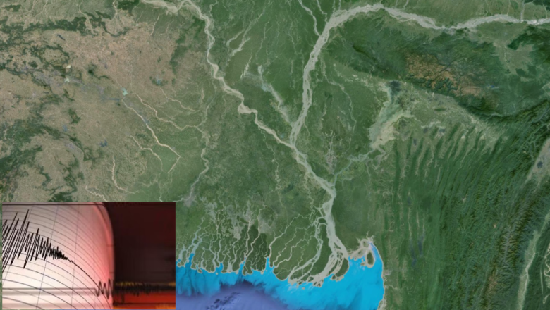
On August 8, 2024, a magnitude 7.1 earthquake struck approximately five to ten kilometers off the shores of Miyazaki, a city on Japan's southern island, Kyushu. The earthquake, which occurred at a depth of 25 kilometers, is believed to have originated from the Nankai Trough subduction zone interface. Although the region is no stranger to seismic activity, the recent event has raised concerns about the possibility of a larger megathrust earthquake. Context and Historical Seismic Activity The Nankai subduction zone is notorious for producing massive earthquakes, with magnitudes ranging from 8 to 9, occurring approximately every 100 to 200 years. However, the recent magnitude 7.1 shock occurred in a zone characterized by repeating magnitude ~7 earthquakes every 25 to 30 years, typically...
Ganga Rivers has Likely Altered their Course due to the mega earthquake occured in 2,500 Years Ago: New Study Reveals

Ganga Rivers has Likely Altered their Course due to the mega earthquake occured in 2,500 Years Ago: New Study Reveals

Breaking News, Disasters, Environment, Idea & Innovations
In a groundbreaking discovery, researchers have revealed that an earthquake approximately 2,500 years ago may have caused the Ganga River to abruptly change its course. This seismic event, which was previously undocumented, is believed to have been of a magnitude 7-8 and could have significantly altered the landscape of present-day Bangladesh. The study, published in the journal Nature Communications, suggests that the earthquake was powerful enough to reroute the main channel of the Ganga, one of the most significant rivers in the world. The Ganga, which originates in the Himalayas, eventually merges with other major rivers, including the Brahmaputra and the Meghna, before flowing into the Bay of Bengal. This river system forms the world’s second-largest delta, surpassed only by the Am...
Monsoon Havoc in Himachal Pradesh 100 Lives Lost, Traffic Disrupted as Heavy Rains Continue

Monsoon Havoc in Himachal Pradesh 100 Lives Lost, Traffic Disrupted as Heavy Rains Continue

Breaking News, Disasters
Himachal Pradesh is reeling under the impact of relentless monsoon rains that have claimed 100 lives since June 27 and caused widespread disruption.  Since the onset of the monsoon on June 27, heavy rains have taken 100 lives in Himachal Pradesh, as the state grapples with ongoing weather challenges. As of Thursday, traffic remains severely impacted, with 97 roads closed across various districts, according to state officials. The Meteorological Department has issued an 'orange' warning for Saturday, forecasting heavy to very heavy rainfall, accompanied by thunderstorms and lightning, in Kangra, Mandi, Shimla, and Sirmaur districts. The state emergency operation center reported various causes of fatalities: 30 people died after falling from heights, 23 in accidental drownings, 14 from...
Himachal Pradesh Cloudburst 36 Missing in Rampur Region of Shimla District

Himachal Pradesh Cloudburst 36 Missing in Rampur Region of Shimla District

Breaking News, Disasters
A cloudburst has wreaked havoc in the Samej Khad area of Rampur region in Shimla district, leaving 36 people missing. The disaster has caused severe disruption, with roads washed away and a hydro power project damaged. Deputy Commissioner Anupam Kashyap confirmed the immediate deployment of the National Disaster Response Force (NDRF), State Disaster Response Force (SDRF), police, and other rescue teams to the site. Drones are being used to aid in the search for the missing individuals. The HP Traffic, Tourist & Railways Police have issued an advisory urging people to stay away from riverbanks during the monsoon season due to the rising water levels in the Beas River. The Pandoh and Larji Dams are releasing water to manage the increased flow and silt. The advisory specifically cautio...
New Tool Developed by University of Hawai  Scientists Enhances Long-Term Forecasting of El Niño Events

New Tool Developed by University of Hawai Scientists Enhances Long-Term Forecasting of El Niño Events

Breaking News, Climate Actions, Tech
As severe weather events draw increasing global attention, scientists at the University of Hawai at Mānoa are making strides in improving the forecasting of droughts, floods, and other climate scenarios. Researchers from the School of Ocean and Earth Science and Technology (SOEST) have developed a novel tool that allows for the prediction of El Niño Southern Oscillation (ENSO) events up to 18 months in advance. The research, which integrates insights into the physics of the ocean and atmosphere with predictive accuracy, was recently published in the prestigious journal Nature. "We have developed a new conceptual model - the so-called extended nonlinear recharge oscillator (XRO) model - that significantly improves predictive skill of ENSO events over one year in advance, better than g...
Informing Multi-Hazard Risks for Decision Makers in Moldova’s Agriculture Sector

Informing Multi-Hazard Risks for Decision Makers in Moldova’s Agriculture Sector

Breaking News, Climate Actions
Agriculture is a cornerstone of Moldova's economy, comprising nearly 74% of its territory and being the primary livelihood for 70% of the rural population. However, the sector faces significant threats from prolonged droughts and climate change, particularly in regions like Anenii Noi known for their fertile chernozem soils. These conditions can degrade soil health, reduce crop yields, and increase food prices, illustrating the cascading effects on food security and the economy. IMPACT, in collaboration with the STRIVE Consortium (comprising Acted, Libraries Without Borders, and REACH), and funded by the Agence Française de Développement (AFD), conducted an ABRA to understand and mitigate these risks. The assessment utilized geospatial data to identify natural hazards and social vulnera...
Scientists claims record storm surges to help predict future flooding

Scientists claims record storm surges to help predict future flooding

Breaking News, Climate Actions, Idea & Innovations
Southampton, UK: Researchers at the University of Southampton have conducted the most comprehensive spatial analysis to date of storm surges along the UK and Ireland's coastlines. The findings, published in the June edition of the journal Weather and Climate Extremes, reveal significant regional variations in the intensity and duration of storm surges, with the north of the Irish Sea experiencing the longest and largest surges, while the southwest coast of England sees the shortest and smallest surges. Over a period spanning four decades, the winter seasons of 1989/90 and 2013/14 emerged as the periods with the highest number and most severe storm surge events. These findings were derived from data collected between 1980 and 2017, highlighting 270 extreme storm surge events based on the...
Scientists Warn: Climate Change Could Bring Deadly Heat and Humidity to More Regions

Scientists Warn: Climate Change Could Bring Deadly Heat and Humidity to More Regions

Breaking News, Climate Actions, Learning & Developments
Recent weather patterns have brought extreme heat to many parts of the world, but in most inhabited regions, it typically doesn't become "too hot for people to live," especially in dry climates. In these areas, our bodies can usually cool off through the evaporation of sweat. However, in regions where hot deserts meet warm oceans, dangerous heat and humidity can combine, posing serious health risks. Regions like the Middle East, Pakistan, and India frequently experience deadly combinations of heat and humidity during summer heat waves. The humid air from nearby seas hampers sweat evaporation, preventing our bodies from cooling effectively. Hundreds of millions of people in these areas lack access to air conditioning, making the situation even more dire. Wet Bulb Temperatures and Thei...
Major Earthquake 2,500 Years Ago Likely Altered Ganges River Course, Study Finds

Major Earthquake 2,500 Years Ago Likely Altered Ganges River Course, Study Finds

Breaking News, Disasters, Learning & Developments
A major earthquake more than 2,500 years ago likely caused one of the world's largest rivers to change its course, according to a study published today in the journal Nature Communications. The findings by a global research team suggest that a similar event could have the potential to alter the river's course again in the future. The modern Ganges River, spanning 2,500 kilometers, flows from the Himalayas southeastward into Bangladesh, where it is known as the Padma River. It then connects with the Brahmaputra and Meghna rivers. Currently, the Ganges-Padma is located around 50 kilometers south of Dhaka. However, satellite imagery has revealed evidence of its former course, approximately 100 kilometers from the city. This discovery indicates that a major event, likely seismic activity...
Cascadia Subduction Zone One of Earth’s Top Hazards, Comes into Sharper Focus

Cascadia Subduction Zone One of Earth’s Top Hazards, Comes into Sharper Focus

Breaking News, Disasters, Idea & Innovations
Off the coasts of southern British Columbia, Washington, Oregon, and northern California lies a 600-mile-long strip where the Pacific Ocean floor is slowly diving eastward under North America. This area, called the Cascadia Subduction Zone, hosts a megathrust fault, a place where tectonic plates move against each other in a highly dangerous way. The plates can periodically lock up and build stress over wide areas eventually to be released when they finally lurch against each other. The result: the world's greatest earthquakes, shaking both seabed and land, and generating tsunamis 100 feet high or more. Such a fault off Japan caused the 2011 Fukushima nuclear disaster. Similar zones exist off Alaska, Chile, and New Zealand, among other places. At Cascadia, big quakes are believed to c...