
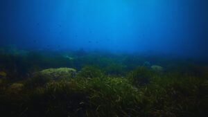
 Beneath the vast network of offshore wind farms, oil rigs, and other marine energy installations lies a complex web of underwater infrastructure pipelines, cables, risers, and anchors that plays a critical role in supporting energy operations. Yet these subsea structures are increasingly threatened by natural events like submarine landslides, which can severely disrupt or destroy vital offshore systems.
Now, a team of researchers from Texas A&M University has developed a cutting-edge approach that could revolutionize the way engineers predict underwater landslides. By applying a structured sequence of site characterization and leveraging advanced statistical modeling, the method allows for more accurate forecasts of these geohazards, potentially safeguarding billions in offshore infrastructure.
Before any offshore construction begins, detailed site investigations are conducted to assess seabed conditions and environmental risks. These assessments typically involve input from geophysicists, geologists, geomatic technologists, and geotechnical engineers. However, the Texas A&M team found that not just the presence of this expertise but the sequence in which their data is collected has a significant impact on the accuracy of landslide prediction models.
The research, published in the journal Landslides, underscores the importance of following a logical progression during site characterization. Beginning with geophysical data collection, followed by geological, geomatic, and geotechnical analysis, helps ensure that predictive models are built on reliable, interconnected datasets. Deviating from this order often due to time or budget constraints can introduce uncertainty into models and reduce confidence in their predictions.
To enhance prediction capabilities, the team employed a probabilistic modeling technique known as Bayesian statistics. This approach allows the model to continuously learn from new data as it becomes available, improving its ability to anticipate potential submarine landslides. By integrating multidisciplinary inputs in a structured way, the method increases both the accuracy and confidence of the results.
Offshore energy companies, which invest heavily in infrastructure, stand to benefit significantly from this research. Uncertainty in site assessments can lead to costly delays or overengineered designs that reduce efficiency. By improving hazard prediction, the new methodology enables better planning and design, ensuring structures are both safe and cost-effective.
This innovative work was led by Zenon Medina-Cetina, an associate professor in the Department of Civil and Environmental Engineering at Texas A&M, alongside Patricia Varela from Geosyntec Consultants and civil engineering student Billy Hernawan. Their contribution represents a major step forward in offshore hazard mitigation and infrastructure resilience.
As global demand for renewable and offshore energy continues to rise, protecting the foundational infrastructure beneath the ocean becomes ever more critical. This new method offers a smarter, more data-driven way to reduce the risks posed by one of the ocean’s most unpredictable threats.