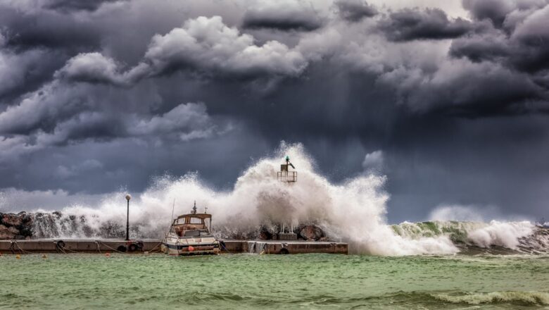
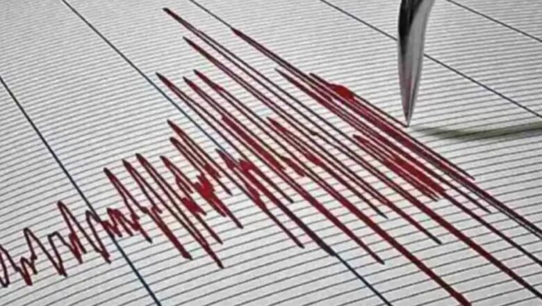
Sunday, February 23News That Matters

Tag: tsunami

Satellite Data Uncovers Years of Warning Signs Before Anak Krakatau’s Devastating 2018 Eruption and Tsunami

Satellite Data Uncovers Years of Warning Signs Before Anak Krakatau’s Devastating 2018 Eruption and Tsunami

Breaking News, Learning & Developments, Tech
A groundbreaking analysis of satellite data has revealed that the catastrophic 2018 eruption and collapse of Indonesia’s Anak Krakatau volcano which triggered a deadly tsunami was preceded by years of subtle but accelerating movements along its mountainside. Researchers at Penn State University found that the volcano's flank had been slipping for over a decade, showing signs that could have potentially served as an early warning if monitored in real time. The study, recently published in Geophysical Research Letters, highlights how advanced radar satellites can detect minute ground deformations, helping scientists track unstable ocean volcanoes and predict possible collapses before they occur. "Ocean volcanoes, when unstable, can collapse catastrophically and generate tsunamis," expl...
Satellite Data Reveals Warning Signs Before Anak Krakatau Tsunami Disaster

Satellite Data Reveals Warning Signs Before Anak Krakatau Tsunami Disaster

Breaking News, Climate Actions, Disasters
A new study has revealed that Indonesia’s Anak Krakatau volcano, which collapsed in a devastating 2018 eruption and triggered a deadly tsunami, had been slipping for years showing warning signs that could have been detected in advance. Researchers at Penn State analyzed satellite data and found that the mountainside had been slowly shifting before its collapse, offering valuable insight into predicting similar disasters in the future. Published in Geophysical Research Letters, the study used a technique called Interferometric Synthetic Aperture Radar (InSAR) to track surface deformation over a 12-year period. The analysis showed that the detachment fault beneath Anak Krakatau experienced approximately 15 meters (50 feet) of movement from 2006 to 2018, with notable acceleration just befo...
Massive Underwater Landslide Discovered in Krishna-Godavari Basin: Potential Tsunami Threat Identified

Massive Underwater Landslide Discovered in Krishna-Godavari Basin: Potential Tsunami Threat Identified

Breaking News, Disasters, Fact Check
A massive underwater landslide in the Krishna-Godavari (KG) basin, reaching depths of 950 meters to 1.1 kilometers below the ocean surface, has raised concerns about its potential to trigger a tsunami and disrupt critical infrastructure. The discovery was announced by the Goa-based National Institute of Oceanography (NIO), which described the landslide as one of the largest ever recorded in this part of the Bay of Bengal. The landslide, which could have occurred between 2009 and 2015, displaced an estimated 11 cubic kilometers of sediment—enough to fill around 44 lakh Olympic-sized swimming pools. At some points, sediment deposits from the landslide are as thick as 60 meters, covering an area of approximately 70 square kilometers, equivalent to 10,000 football fields. “The enormous d...
Honoring 20 Years: World Tsunami Awareness Day Commemorates the 2004 Indian Ocean Tragedy

Honoring 20 Years: World Tsunami Awareness Day Commemorates the 2004 Indian Ocean Tragedy

Breaking News, Disasters, Thoughts & Talks
This year’s World Tsunami Awareness Day (WTAD) takes on profound significance as it marks the 20th anniversary of the devastating 2004 Indian Ocean Tsunami. Observances aim to honor the lives lost, highlight critical lessons learned, and celebrate advancements in tsunami preparedness, especially through initiatives like the #GetToHighGround campaign, which empowers children and youth with life-saving knowledge. On the morning of December 26, 2004, a magnitude 9.1 earthquake struck along the Indian Ocean subduction zone, triggering one of the deadliest tsunamis in modern history. The massive waves obliterated 800 km of Aceh Province's coastline in Indonesia, penetrating as far as 6 km inland. The disaster radiated destruction across the Indian Ocean, from Indonesia and India’s Andaman an...
Tonga Strengthens Disaster Preparedness With Tsunami Drills

Tonga Strengthens Disaster Preparedness With Tsunami Drills

Breaking News, Climate Actions, Disasters
According to our sources Residents of Tonga including students participated in a series of tsunami drills designed to enhance awareness and preparedness for future natural disasters. The drills focused on rapid evacuation and community coordination, crucial skills for the island nation, which is highly vulnerable to tsunamis. These exercises reflect Tonga's commitment to building resilience against climate-induced disasters. Preserving Pacific Heritage: Coconut Leaf Weaving Traditions Across the Pacific, the art of coconut leaf weaving continues to thrive, preserving a centuries-old cultural tradition. This intricate craft holds different meanings for Pacific communities, from practical uses like roofing and baskets to symbolic significance in ceremonies. Efforts to pass on this skil...
Fiber Optic Cables: The Future of Earthquake Detection

Fiber Optic Cables: The Future of Earthquake Detection

Breaking News, Disasters
Submarine communication cables, like the intricate network branching off from Japan, illustrate our planet's interconnectedness. These cables, with their colorful lines connecting Japan’s islands to the rest of the world, are not only vital for data transmission but may also be key to detecting natural disasters. Innovative Use of Existing Infrastructure Dr. Tonegawa and his team highlight the potential of Distributed Acoustic Sensing (DAS) technology, which could transform submarine cables into extensive seismic monitoring networks. DAS offers two major advantages over traditional seismic tools: Governments and companies globally have already laid about 1.4 million kilometers of submarine cables. Although DAS cannot be applied along the entire length of these cables, collaborat...
Scientists Warn Cascadia Faultline Could Trigger Catastrophic Earthquake and Tsunami on West Coast

Scientists Warn Cascadia Faultline Could Trigger Catastrophic Earthquake and Tsunami on West Coast

Breaking News, Disasters
Scientists have raised alarms about the Cascadia Subduction Zone, an underwater faultline off the west coast of America, that could unleash a devastating earthquake and tsunami at any moment. This faultline spans 600 miles (966 kilometers) from Southern Canada to Northern California. Recent underwater mapping has revealed that this faultline, typically divided into two parts, is now splitting into four sections, indicating heightened risk. The Cascadia Subduction Zone has been identified as a major geological threat due to its immense potential for seismic activity. If there is even slight movement in the tectonic plates here, it could trigger catastrophic destruction. Scientists warn that this faultline could generate an earthquake with a magnitude exceeding 9.0, far surpassing the cap...
Magnitude 6.3 Earthquake Strikes Vanuatu: No Tsunami warning issued by agency

Magnitude 6.3 Earthquake Strikes Vanuatu: No Tsunami warning issued by agency

Breaking News, Disasters
A magnitude 6.3 earthquake hit the Pacific nation of Vanuatu on Sunday morning, according to the United States Geological Survey (USGS). The tremor occurred at 9:23 am local time at a depth of approximately 29 kilometers (18 miles) below the ocean's surface. Its epicenter was located about 83 kilometers (51 miles) northwest of Vanuatu's capital, Port Vila. Despite the earthquake's significant magnitude, the Pacific Tsunami Warning Centre confirmed that it is not expected to generate a tsunami. The quake struck near a sparsely populated cluster of islands, reducing the immediate threat to heavily populated areas. As of now, there have been no reports of damage or casualties. Authorities in Vanuatu are monitoring the situation closely and have advised residents to stay alert for potent...
Sun Unleashes Monster Solar Flare, Radio Blackouts Expected On Earth

Sun Unleashes Monster Solar Flare, Radio Blackouts Expected On Earth

Breaking News, Environment, Space
The Sun has emitted its strongest flare of the current solar cycle, a category X8.7 storm, sending a powerful surge of energized particles hurtling towards Earth. The flare, originating from sunspot AR3664, is anticipated to cause radio blackouts upon impact, particularly affecting regions such as the United States. In a dramatic display of solar activity, the Sun has unleashed its most potent flare of the current solar cycle, sending shockwaves of energized particles hurtling towards Earth. Originating from an active sunspot designated AR3664, the flare, classified as a category X8.7 storm, represents a significant escalation in solar activity. According to reports from the National Oceanic and Atmospheric Administration (NOAA), the sunspot responsible for the flare is situated at t...
Japan Earthquake Tsunami Updates: All Warnings for Tsunami has been Lifted

Japan Earthquake Tsunami Updates: All Warnings for Tsunami has been Lifted

Breaking News, Disasters
Japan Earthquake and Tsunami Live updates: Japan meteorological official said that the small changes to tidal levels are still possible. So, the country lifted all tsunami warnings and advisories put in place after a major quake on New Year's Day. A day after Japan was struck by a powerful earthquake of 7.6 magnitude, in the middle of the afternoon on Monday. The country lifted all tsunami warnings and advisories put in place after a major quake on New Year's Day, a meteorological agency official told. The quake with a preliminary magnitude of 7.6 struck in the middle of the afternoon on Monday, prompting residents in some coastal areas to flee to higher ground as tsunami waves about 1 metre (3.3 ft) hit Japan's western seaboard. Japan meteorological official said that the small c...